Listeners:
Top listeners:
00:00
00:00
volume_up
chevron_left
-
 play_arrow
95.3 The Farm
-
play_arrow
98.7 Lite FM
-
play_arrow
WHOP AM





 Depth will be key for CCHS Tigers in inaugural football season
 Todd Co. Water District issues boil water advisory for the Pilot Rock Road area
 Victim identified, investigation continues into residential explosion in Central City
 Missing Madisonville woman found safe
 14-year-old injured in Clarksville crash expected to recover


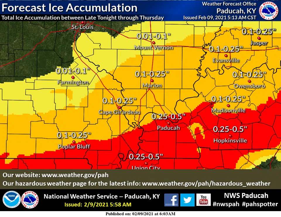
Winter Storm Watch Midnight Wednesday through 6 p.m. Thursday
From NWS in Paducah:
...WINTER STORM WATCH NOW IN EFFECT FROM LATE TONIGHT THROUGH
THURSDAY AFTERNOON...

* WHAT...Heavy mixed precipitation possible. Total snow
  accumulations of up to a half inch and total ice accumulations
  of one quarter to locally one half inch possible.

* WHERE...Delta region of southeast Missouri, western Kentucky,
  and extreme southern Illinois.

* WHEN...From late tonight through Thursday afternoon.

* IMPACTS...Plan on slippery and dangerous road conditions. The
  hazardous conditions will impact the morning or evening commute.
  Damage to some trees and local power outages may occur due to
  the accumulating ice.

PRECAUTIONARY/PREPAREDNESS ACTIONS...

Monitor the latest forecasts for updates on this situation.