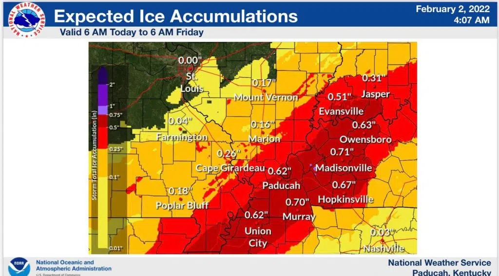
All of Western Kentucky, including Christian, Todd and Trigg counties, is now under an ice storm warning with significant impacts expected.
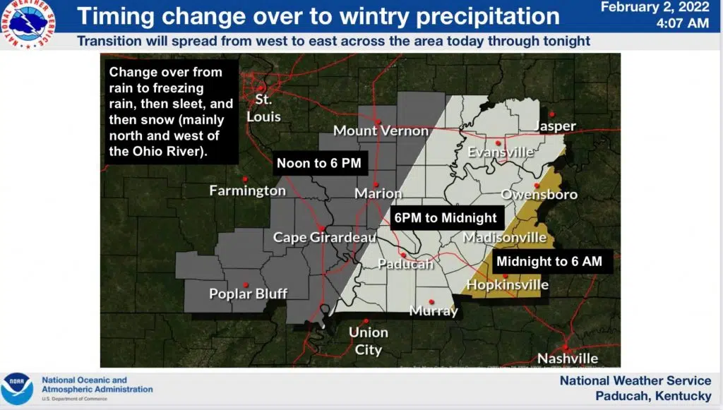
The warning is from 6 p.m. this evening until 6 a.m. Friday, with fourth tenths to three quarters of an inch of ice expected and up to an inch of snow. The changeover from rain to freezing rain in the southern Pennyrile is expected to come between midnight and 6 a.m. Thursday.
The time of greatest ice accumulation is expected to be between noon and 6 p.m. Thursday.
Meteorologist Andy Lesage with the National Weather Service in Paducah said during a conference call Tuesday afternoon that travel impacts will be the largest issue.
Power outages hopefully won’t be widespread or long-lasting, but they will be possible where ice accumulates.
Stay tuned to the WHOP Family of Stations and monitor our websites and social media outlets for the latest on this winter weather system.