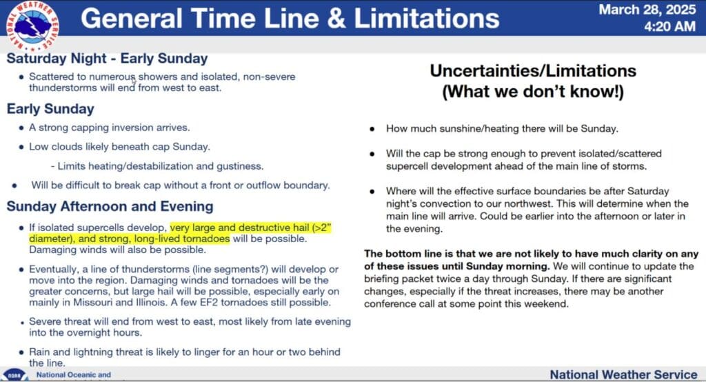
Sunday brings another risk for severe weather and if the conditions can align, then possibly significant risks could be in the cards.
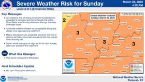
As of Friday afternoon, the National Weather Service in Paducah has all of western Kentucky and surrounding areas, including Christian, Todd and Trigg Counties, under an Enhanced Risk for severe weather, and western Kentucky is even in the ‘hatched’ area, which signals the possibility of significantly severe weather.
Meteorologist Dan Spaeth says all risks are on the table, including damaging winds, a couple of tornadoes and potentially extremely large hail.
One of the main unknowns is what time exactly will that front that’s bringing storms with it move through our region—Spaeth says it could still change in the hours leading up to it, but right now they’re thinking this will be an afternoon and into the evening hours event.
Some conditions could still be lacking that day, thanks to some non-severe thunderstorms in the area Saturday night into Sunday morning, with cloud cover during the day helping keep the atmosphere stable.
That said, it’s likely western Kentucky will experience some type of severe weather on Sunday, so stay tuned to the National Weather Service and the WHOP Family of Stations for any watches or warnings that may develop with this spring storm system.