Forecasters remain concerned about the possibility of a significant severe weather outbreak in western Kentucky this afternoon and evening.
The entire listening area remains under a moderate risk of severe weather, with damaging winds, tornadoes and large hail all possible.
Justin Gibbs is a meteorologist with the National Weather Service in Paducah and said during a conference call Friday morning that residents should be alert and prepared to react to any warnings.
The region could potentially avoid the worst of the severe weather if cloudy skies and rain showers persist throughout the day, but the atmosphere will likely remain unstable enough to support storm development.
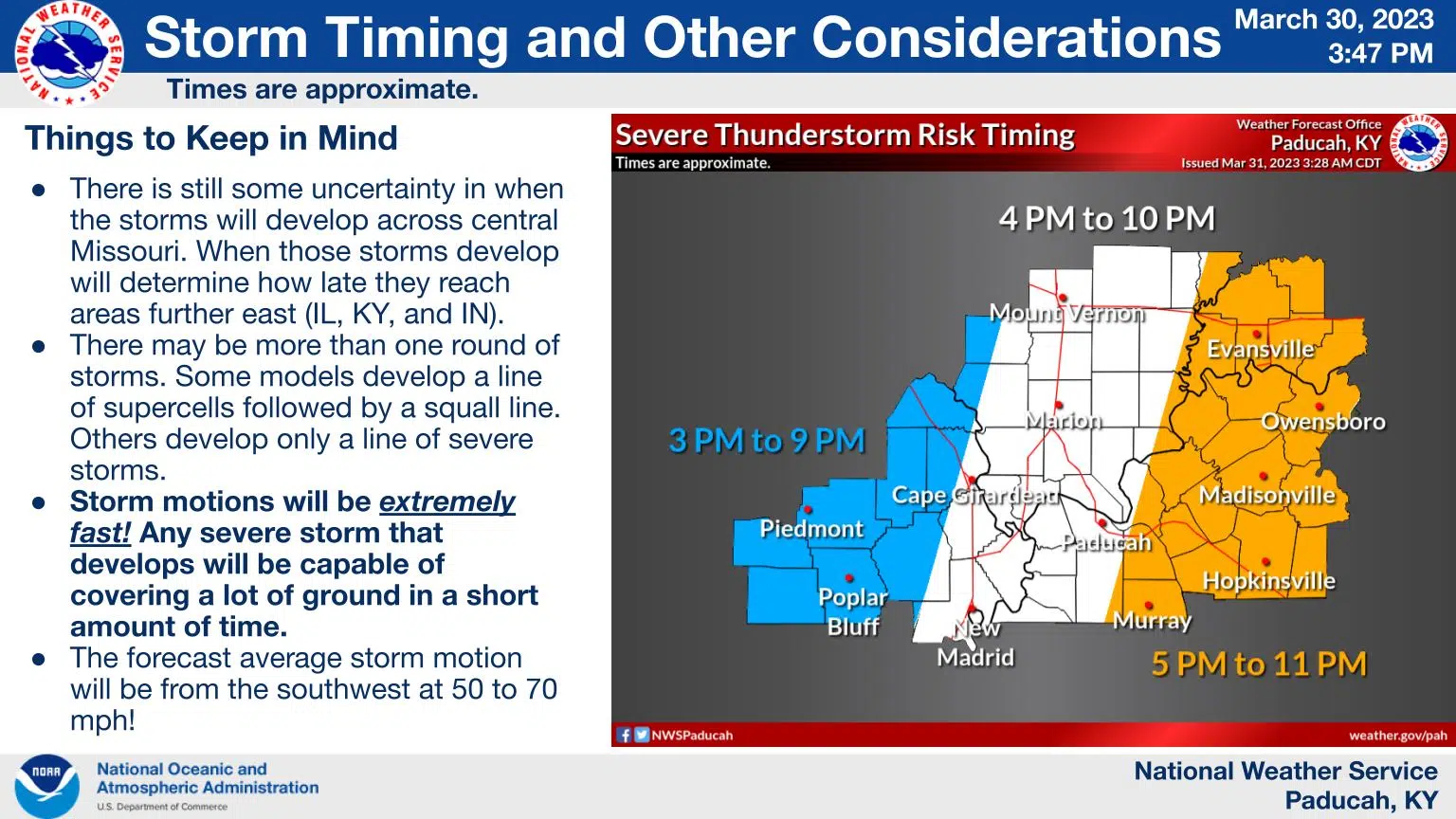
Gibbs says the best guess is storms could move eastward into Trigg County as soon as 6 or 6:30 and there’s some hope storms may weaken slightly as the heat of the day wanes.
Governor Andy Beshear urges Kentuckians to go over their safety plans and to be prepared to take cover if a tornado warning is issued.
A Wind Advisory is also in effect from 1 p.m. today until 1 a.m. Saturday for the entire listening area, as sustained winds could reach 30 mph and gusts could get as high as 45 mph.
Stay tuned to the WHOP Family of Stations and monitor our social media outlets for any potential watches or warnings.