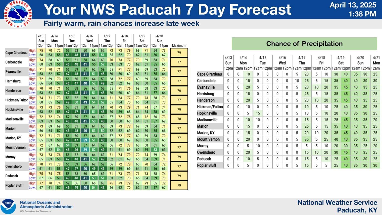
As floodwaters across the region stagnate and slowly recede, the National Weather Service in Paducah expects a week of calm weather with slight chances for rain.
Forecaster Keith Cooley says as floodwaters drain into bodies of water, some rivers are set to crest, but he expects water levels to start lowering by the end of the week.
Cooley says parts of western Kentucky could receive some light rain on Monday evening and Thursday due to a cold front, but more widespread rain and thunderstorms are expected during the weekend as another cold front moves through. Up to a half-an-inch of rain could fall across the region by Sunday.
The cold front will result in temperatures on Tuesday and Wednesday reaching highs in the 60-degree range, but toward the weekend, daily highs will reach the 70-degree range.
On Friday, a slight risk for severe weather is looming northwest of the weather services’ coverage region in Illinois and Missouri. Cooley says there is a chance that the weather system could end up traveling more south so they are keeping an eye on it.
Turning toward next week, Cooley says rain chances will continue, but they are unsure about the amounts.
The Paducah radar system is currently down, and it should be back up and running by Thursday.