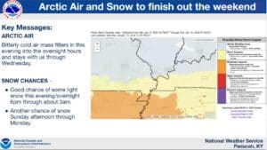
Our first real chance of snow since last winter will make its way through the region Sunday night into Monday, and it’s bringing with it some frigid temperatures.
The big story is how cold it’s going to be—most place will fall to near zero, if not a little below it, and that paired with the wind chill will make it dangerously cold outside. Warning Coordination Meteorologist Christine Weilgos with the National Weather Service in Paducah says it will be shockingly cold and urged people to take it seriously—there will be a brief “warm up” in the middle of the week before another cold snap puts it back down.
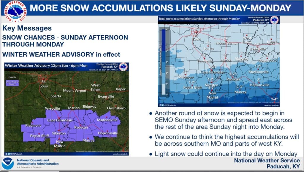
All of western Kentucky is now under a Winter Weather Advisory from noon Sunday until 6 p.m. Monday, where it’s likely some snow will fall. Counties near the Tennessee border, such as Christian, Todd and Trigg counties, could see around two inches fall in that time frame, with isolated higher amounts possible.
Weilgos says anything that does fall will be all snow, thanks to the temperatures, and it should be a fully, light snow that can still affect travel conditions.
Before that though, don’t be surprised if you see some snow in the air Saturday night, though anything that accumulates would likely be just a dusting.
Crews with the Kentucky Transportation Cabinet have been out pre-treating state roads with salt and brine, and if you must get out on any roads that are snow covered, remember to slow it down and give yourself plenty of extra time to make it to your destination safely.