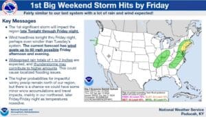
The weather is taking hard turn into true winter this coming weekend, and it all starts with a storm system on Friday that will bring rain and high winds to the region.
All of western Kentucky is now under a High Wind Warning, with wide spread wind gusts of 40 miles per hour likely with stronger gusts of up to 60 miles per hour possible at times, starting around late Friday morning and going into the night. Meteorologist David Humphrey with the National Weather Service in Paducah says this event will be similar to March 3 of 2023.
A severe thunderstorm or two is certainly possible, with Humphrey saying if those do develop, they could bring even higher isolated wind and an isolated tornado cannot be ruled out.
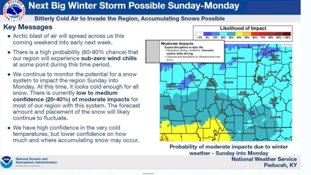
Then, attention turns towards Sunday night into Monday morning, as temperatures rapidly plummet and another system brings the chance for snow, though exactly how much could fall and where remains uncertain.
Humphrey says anything that does fall will do so as entirely snow, based on how cold it will be. People are urged to winterize their homes and vehicles now, make sure vulnerable pipes are protected and that outdoor animals are given proper shelter from the elements, as temperatures will likely drop into the single digits—and that’s not accounting for wind chill.
How long this cold snap may last remains to be determined and the forecast for snow will likely change, so stay tuned to the WHOP Family of Stations for more on this developing winter system.