A dynamic storm system is set to move into the area late Thursday night and continue into Friday, with the potential for heavy rain, damaging winds and brief tornados all present.
Science and Operations Officer Chris Noles with the National Weather Service in Paducah says they’re concerned about the combination of heavy rain and strong winds, with all of western Kentucky and surrounding areas under a Wind Advisory until Friday afternoon. Noles says the rain would begin late Thursday night and continue through noon Friday.
The time of most concern for severe storms in the Christian County area would be between 8 a.m. and 11 a.m. Friday.
Noles says heavy downpours, gusty wind and spin-up, brief tornadoes are possible with any storms that develop.
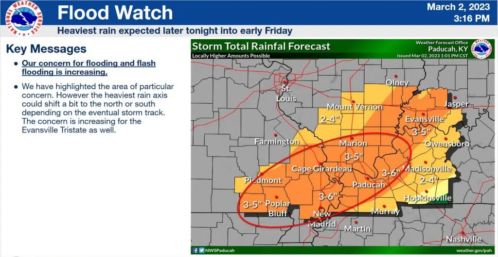
A Flood Watch is in effect from 6 p.m. Thursday until noon Friday for much of western Kentucky, including Hopkins, Trigg and counties to the west. The entire region could see two-to-three inches of rain, with isolated higher amounts possible.
Christian, Todd, Muhlenberg and Logan counties are under an enhanced risk for severe weather Friday, while the remained of the region is under a slight risk.
Stay tuned to the WHOP Family of Stations and monitor our social media outlets for the latest on this developing weather system.