Photo: Fort Campbell Boulevard at Gate 4 early Monday morning/KYTC Cam
A major winter storm carrying six inches to a foot of snow began Sunday night in western Kentucky and the biggest punch has yet to arrive.
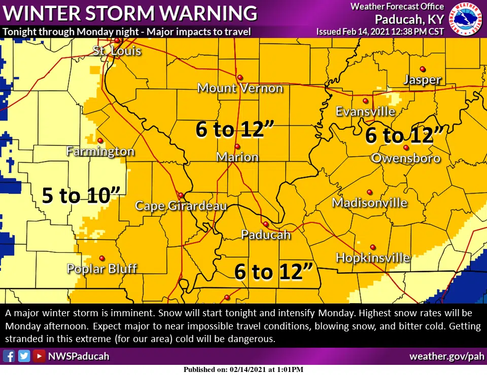
A Winter Storm Warning remains in effect until 6 a.m. Tuesday for all of western Kentucky and Middle Tennessee.
Christian County Sheriff’s Sgt. Adam Vanderkolk reported roads to be ice and snow-covered from precipitation overnight.
Similar reports were given across the region, with snow sticking immediately in the bitter cold and coating roadways.
The National Weather Service in Paducah hosted another conference call Sunday evening and Lead Forecaster Chris Noles says the main event is set for later today.
High temperatures will struggle to get above 20 and Noles says the cold and wind will make it dangerous for anyone getting stuck outdoors.
Traveling isn’t advised anytime Monday, but Noles says conditions will deteriorate even further very rapidly Monday afternoon into the evening with heavy, blowing snow.
Noles says the region is approaching meeting the criteria for a blizzard warning, though he doesn’t expect us to quite get there.
Most school systems were already closed Monday for professional development or the President’s Day holiday, but there are some districts closed by the weather including Clarksville-Montgomery County Schools, Muhlenberg County and Dawson Springs Independent Schools and they’re using virtual learning.
State, county and city road crews have been preparing and will deploy to plow and treat major roadways first—though the effectiveness of the salt and brine solution is greatly reduced with the bitter cold temperatures.
Another weather system could produce more wintry precipitation Wednesday and Thursday, with more information to come on that later in the week.