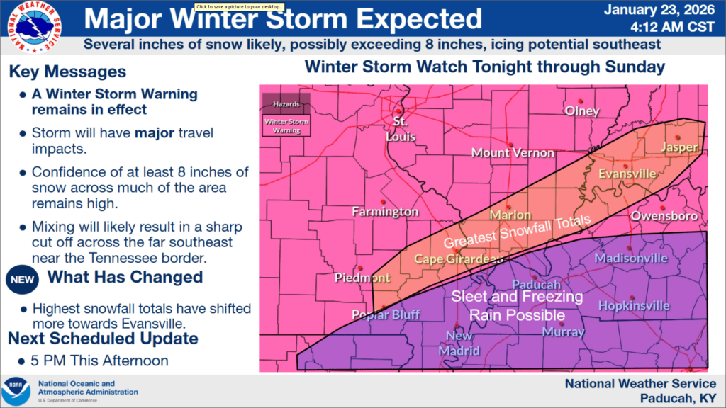
As Winter Storm Fern gets ready to crash into the region, a Winter Storm Warning is in effect for our entire listening area.
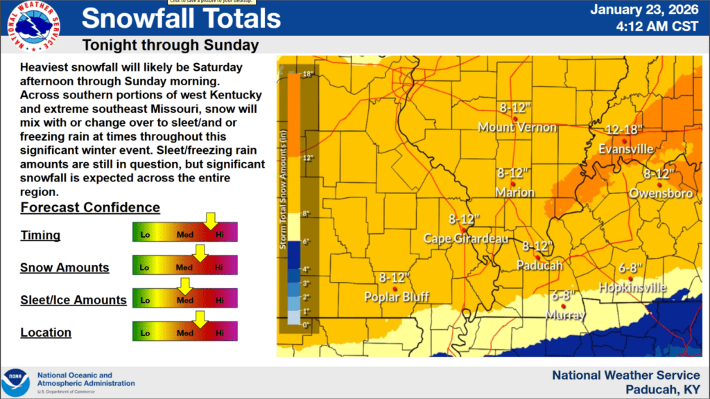
And some things have change as this winter weather system is set to start impacting the region late tonight and then linger through Sunday afternoon, as the chances for ice accumulations have increased for Christian, Todd, Trigg and surrounding counties. Warning Coordination Meteorologist Christine Wielgos with the National Weather Service in Paducah says this is the trickiest part of this forecast—determining where the line between heavy snow and sleet or freezing rain will set up.
The most likely area to get ice is the southern Pennyrile region. The event would begin as all snow, snow through the bulk of the day Saturday, and then transition to either sleet or freezing rain Saturday night. That ice would fall on top of already accumulated snow, which is just going to cause significantly hazardous conditions on area roadways.
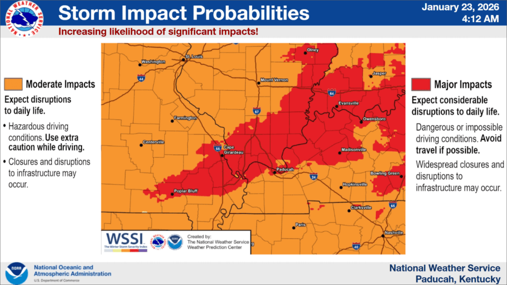
Meteorologist Kate Shawkey says they’re expecting moderate to major impacts, with travel becoming outright impossible at times.
She says thanks to frigidly cold arctic air, anything that falls will stick around for a while, which means travel will stay hazardous for quite some time.
Unfortunately, if we do get some ice, that does increase our risk of power outages. Shawkey says they’re not expecting widespread power outages, but people should be prepared just in case.
They both urged for people to be safe while staying warm—don’t plug those space heaters into extension cords or power strips, don’t use an open over or cook tops to heat a space unsupervised, and make sure you have an emergency kit ready in the event you get stranded while driving.
More details will likely be ironed out all the way up until the event begins, so make sure you stay tuned to the WHOP Family of Stations and the National Weather Service in Paducah as more information becomes available.