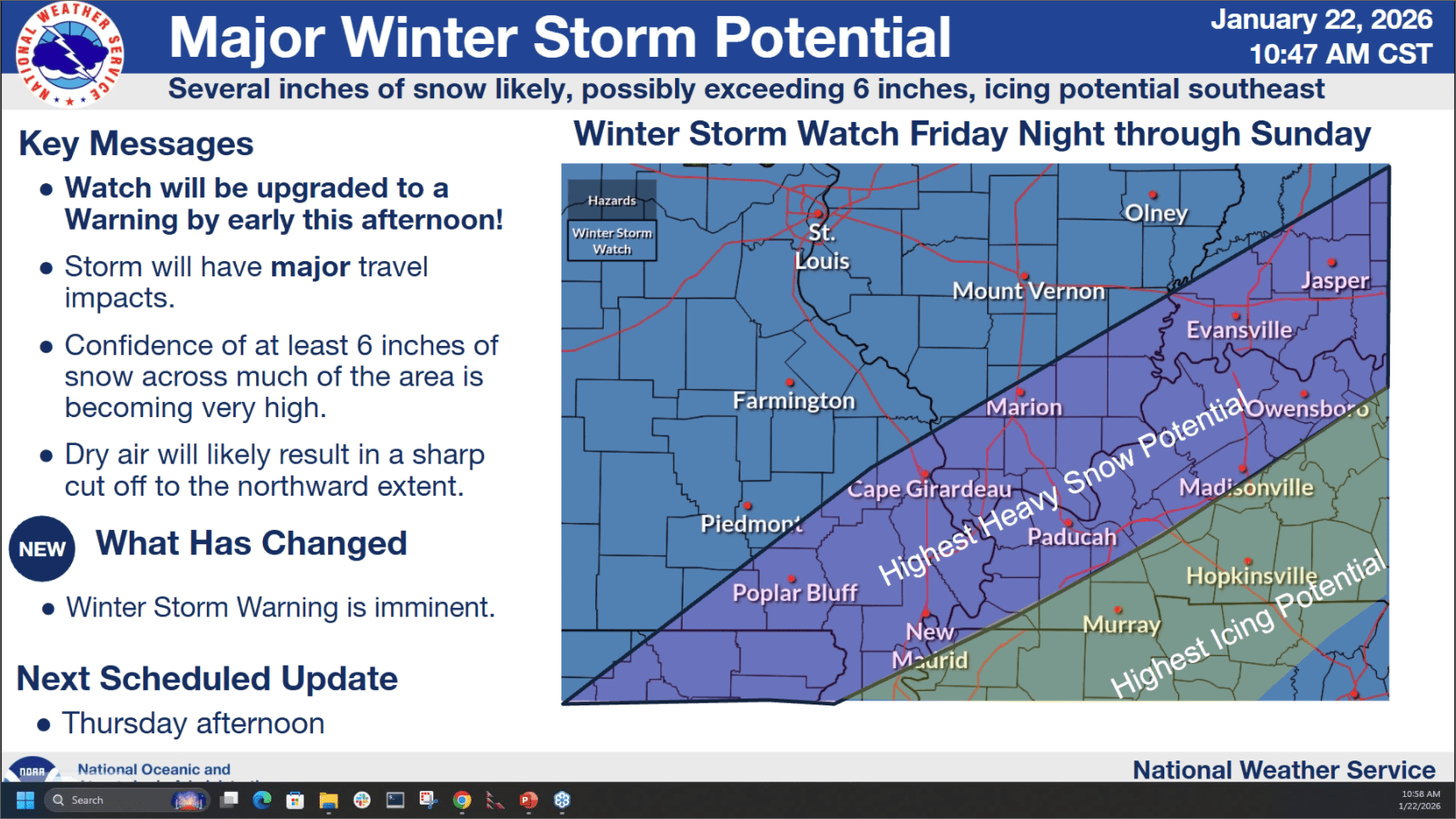
A Winter Storm Warning will be issued in the coming hours for all of western Kentucky, and in fact, this entire region, as our chances for impactful winter weather this weekend have become almost a certainty.
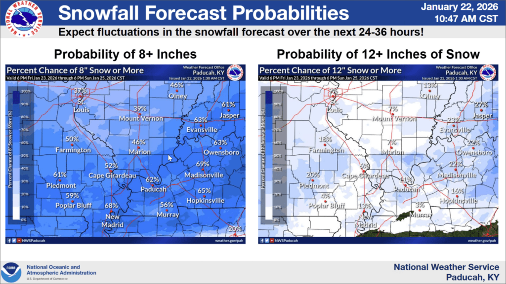
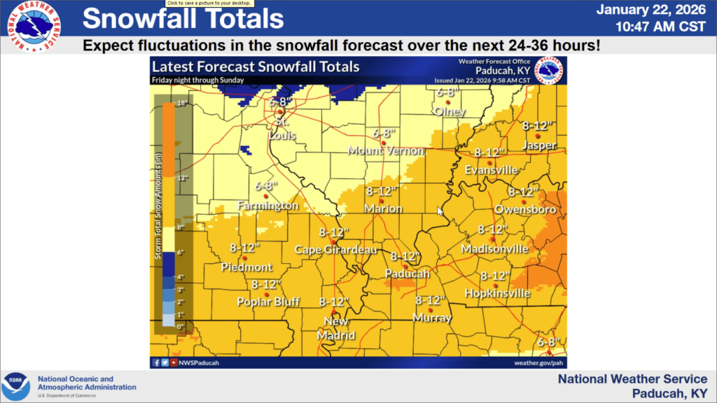
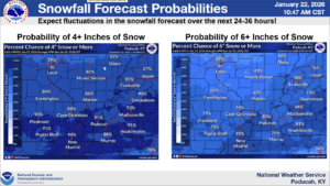
Dubbed Winter Storm Fern, this weather system will bring multiple inches of snow and even maybe some ice to the area starting late Friday night and lingering through Sunday afternoon. Forecaster Rachel Trevino with the National Weather Service in Paducah says it is as close to a guarantee that they can get that everyone will see several inches of snow. And those amounts could be anywhere between four inches and ten inches, with isolated higher amounts possible, though the likelihood of seeing eight inches is quite high.
Along the Tennessee border, western Kentucky counties such as Christian, Trigg, and Todd could even see a wintry mix of precipitation, including freezing rain and sleet.
While that icy accumulation could cut down on our snow amounts, it would only help make area roadways even more hazardous, and Trevino says travel could even become impossible at times.
Trevino says this is no ice storm, but isolated power outages can’t be ruled out where any ice may fall.
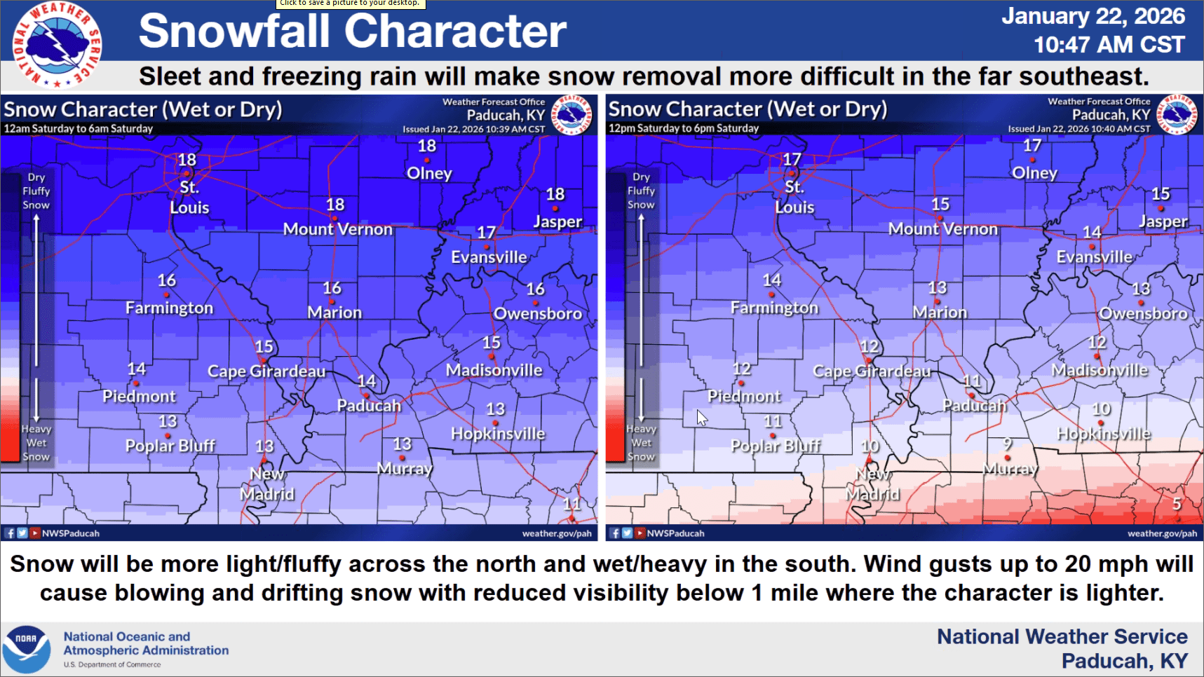
The tricky part about forecasting winter storms is that many details won’t be known until the event actually begins—so things could still change. While areas to our north will receive fluffier, lighter snow, the Christian County area is looking at a wet, heavy snow that will make clean-up trickier for road crews.
Stay tuned to the WHOP Family of Stations and the National Weather Service in Paducah for any watches, warnings and information that will be posted as this system moves into our area.