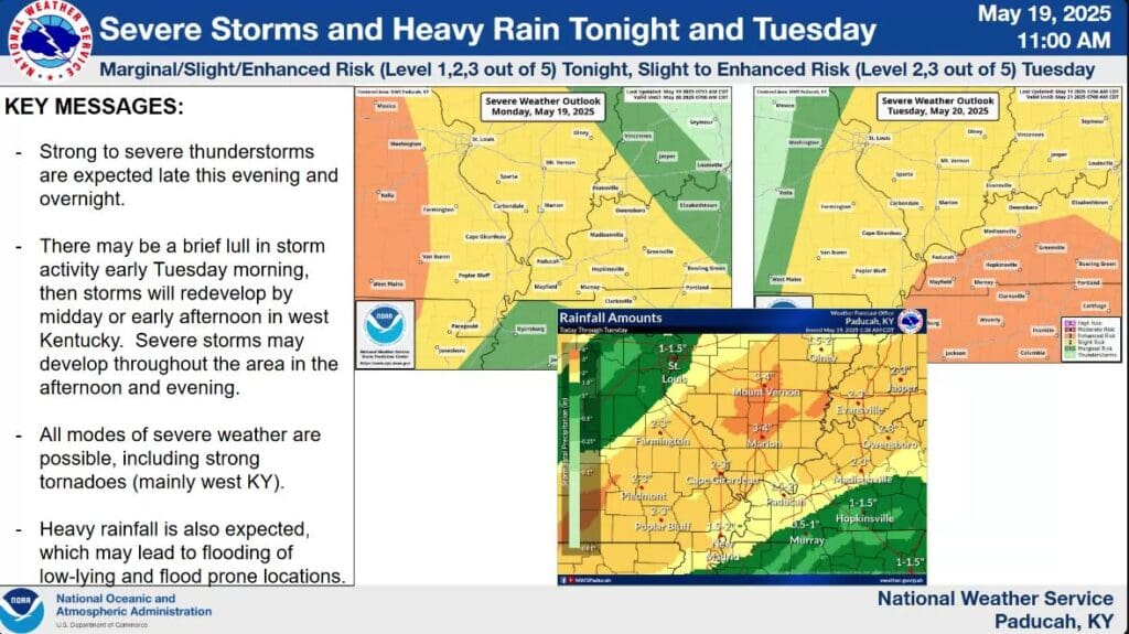
There seems to be no rest for the weary, as western Kentucky is back under the gun for severe weather both Monday night and an elevated risk on Tuesday.
Right now, the whole region—including Christian, Todd and Trigg Counties—is under a Slight Risk for severe weather Monday night into Tuesday morning, and then severe storms are expected to fire back up Tuesday, brining with them an Enhanced Risk to the area.
Lead Forecaster Daniel Spaeth with the National Weather Service in Paducah says the timing for Monday’s system will be starting around 9 p.m. and lingering through the overnight hours. Monday would have mostly a damaging winds and hail threat, but a spin-up tornado can’t be ruled out.
Then, severe storms could fire back up as soon as mid-morning Tuesday and then last into the evening hours, with all modes of severe weather possible, including tornadoes.
There remains a lot of uncertainty for Tuesday’s weather, including the precise timing storms may develop. If the clouds clear out in the morning and let the atmosphere recharge, then we’ll back in the mix for severe weather.
Once we get through Tuesday’s weather, Spaeth says the data is trending cooler than average with above average chances for precipitation, but with nothing too concerning severe weather wise.
Stay tuned to the WHOP Family of Stations for any watches or warnings that come about with this severe weather system.