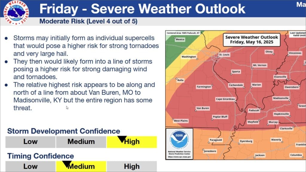
A weather system coming to western Kentucky could result in some storms with a majority of the region under a moderate risk for severe weather on Friday.
Western Kentucky is under a slight risk for severe weather, and storms could develop from 3 p.m. to 8 p.m. on Thursday and 1 a.m. to 6 a.m. Friday. However, Forecaster Keith Cooley with the National Weather Service in Paducah says their confidence is low when it comes to severe storms developing due to warm air in the region.
Later in the day on Friday, Cooley says the region has been upgraded to a moderate risk for severe weather, which includes Christian, Todd and Trigg Counties. He expects storms to start firing up in the late morning and to last until evening.
Cooley is confident that storms will develop on Friday due to atmospheric instability. Storms could include large hail, hurricane-force winds, and possible tornadoes.
Any storms that develop could produce a significant amount of rain. However, Cooley says storm systems will be moving quickly, so at most some places could receive around two inches of rain, which could cause flash flooding concerns.
During the weekend, Cooley says storms won’t be sticking around, but could return on Tuesday.