Another storm is set to sweep across the state, but instead of bringing rain, this system is set to bring snow and icy temperatures.
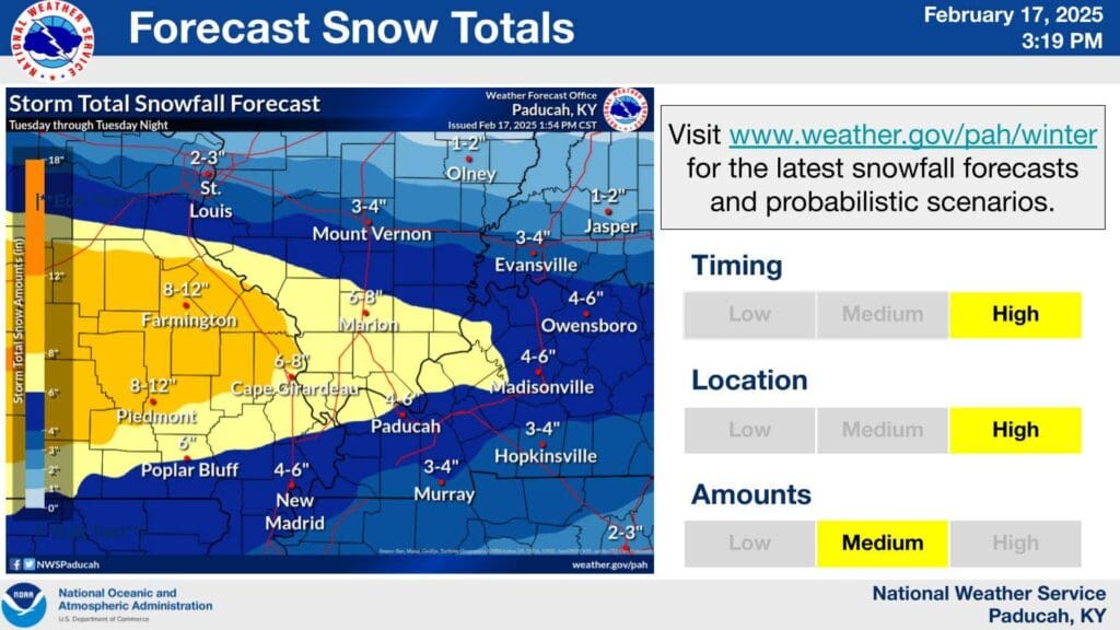
A majority of Kentucky is under winter storm warning as a cold front is set to move east across the state. Meteorologist Chris Noles from the National Weather Service in Paducah says the warning is set from noon Tuesday to 9 a.m. Wednesday morning.
During that time Noles says the weather service is expecting snowfall to impact travel and for wind chills be around zero degrees.
Noles says they are expecting four-to-six inches of snowfall across most of the region, but closer to the Tennessee border in Hopkinsville and Murray they are expecting around three-to-four inches of snowfall.
In the Christian, Todd and Trigg County area, heavy snow is expected to start between 4 p.m. to 7 p.m. on Tuesday and is set to conclude by 7 a.m. Wednesday morning. Noles says they are expecting a light fluffy snow.
Temperatures are set to peak back above freezing on Saturday.