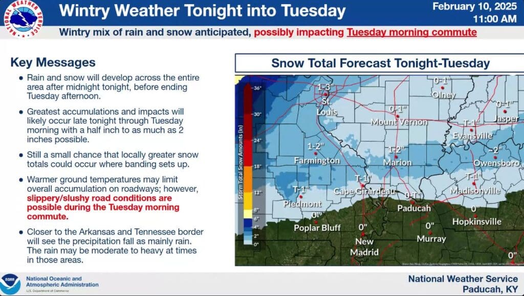
There are two wintry weather systems set to make their way through the region this week, but it’s looking like the Christian, Todd and Trigg County areas will see mostly rain.
The first of our systems moves through late Monday night and into Tuesday morning, and it brings with it our greatest chance for snow in the air, but it will be a mostly rain event for counties along the Tennessee border. Meteorologist Andy Lesage with the National Weather Service in Paducah says the further north you go, the higher your chances of snow.
This first system will bring with it cooler temperatures and the week will stay fairly seasonable.
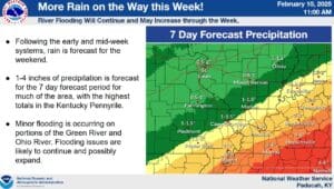
Then, the second system will start making its way through Wednesday night into Thursday, bringing some chances for wintry weather to areas to our north, but only more rain for us. Even more rain is set to arrive in the weekend, so needless to say, minor flooding issues could be likely, especially in the usual low-lying and poor drainage areas.
Then, February looks to keep up the trend, with above average chances for rain in the long-range forecast, with about normal temperatures.