After a weekend full of severe weather, the region looks to enjoy a break of calm weather this week before rain chances return.
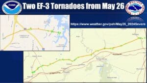
Forecaster Sean Poulos with the National Weather Service in Paducah says they are still conducting surveys of damages across the state from Sunday’s weather, and it’s looking like at least two EF-3 tornados touched down in the region, with the rating for a tornado that tracked north of Dawson Springs possibly increasing.
Now, people can enjoy dry, warm and sunny weather for the work week, before rain chances move back in just in time for the weekend.
There could be a chance for strong-to-severe storms Monday and Tuesday of next week, but Poulos said they’re not getting any signals that it would be anything like the last severe weather event.
Then, in the 8-to-14 day outlook, things are trending cooler than average temperature wise, with about normal chances for precipitation.


