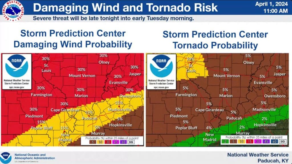
April is coming in with a bang, as the threat of severe weather including all hazards howls through the region Monday night and into Tuesday.
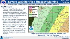
The big threat is to our north Monday night into early Tuesday morning, but severe storms are possible in the region with damaging winds and large hail the main threats, but tornadoes are certainly possible. That system will enter our area sometime between 2 a.m. and 6 a.m. and Derrick Snyder with the National Weather Service in Paducah urges people to have multiple ways to receive warnings that will wake you up.
Then, portions of Christian and Trigg counties, along with all of Todd County, are under an Enhanced Risk of severe weather from the early morning hours Tuesday until about mid-day. Snyder says that looks to be mostly a damaging wind threat, but a spin-up tornado can’t be ruled out.
After the cold front blows through, the weather turns cool and breezy for the remainder of the week. Eyes then turn to the next solar eclipse making its way through the region on April 8 and while things can certainly change between now and then, Snyder says eclipse chasers won’t be happy to see a decent chance for cloudy skies.
Stay tuned to the WHOP Family of Stations for any watches or warnings that develop from this active spring weather system.