An active weather pattern is setting up over this part of the country for the next couple of weeks, bringing with it chances for snow, especially as very cold temperatures are in store.
A soaking rain will start the week Monday and Tuesday, and some places could see a dusting of snow as that leaves the area, as colder temperatures are following right behind it. But wind will be the main story for that system, with Meteorologist Sean Poulos with the National Weather Service in Paducah saying the area will have gusty conditions the rest of the week.
A Wind Advisory is in place for Christian, Todd and Trigg Counties from 9 p.m. Monday evening through 7 a.m. Tuesday morning.
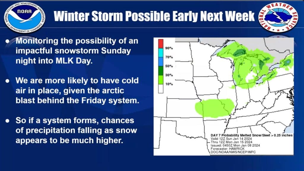
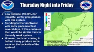
A second system on Friday night brings another chance for snow with it, with confidence low at this time that much accumulation will take place. But a better chance exists for another system next Monday, with Poulus saying somewhere in the region will likely get some solid accumulation.
That’s definitely a long-range forecast, so Poulos urges people to just stay weather aware as we head towards next week, as there will be updates and adjustments to the forecast.
What is looking far more likely is bitterly cold temperatures—Poulos says wind chills could dip towards the zero-degree mark at times.
Those cold temperatures stick around for the 8-to-14 day outlook, which is show colder than averages trends and below average chances for precipitation.