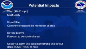
While the rest of this week is looking calm and seasonably cool, attention is turning towards a storm system entering the region early next week—though what shape that system may take, be it storms or snow, remains to be seen.
Right now, the model projections keep the bulk of severe storms to our south, and wintry type precipitation to our north, but a lot could change before that system enters the area by Monday. Meteorologist Justin Gibbs with the National Weather Service in Paducah says who gets what and where depends on how the low-pressure system tracks.
This week is on track to stay calm and cool before rain moves in on Saturday, making way for the bigger system at the start of next week.
Gibbs says a lot of details remain to be ironed out and they’ll have more details as the event gets closer, but it’s likely someone will end up with something, so stay weather aware as you head through the week.
In the 8-to-14 day outlook, things are trending wetter than average while temperatures look to stay in the normal range.


