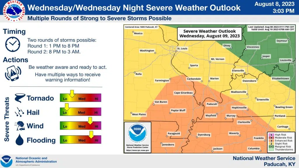
The bulk of western Kentucky, including all of Trigg and portions of Christian and Todd counties, are now under an enhanced risk for severe weather Wednesday.
There will be two rounds of weather, with the first round being the one that carries the highest severe risk, with all hazards possible, including damaging winds and isolated tornadoes. Justin Gibbs with the National Weather Service says the first round will move through our area between 3 p.m. to 8 p.m.
Gibbs says round two of weather—which would be between 10 p.m. to 3 a.m.—contains the higher risk for possible flooding.
With the ground already pretty saturated from recent rains, Gibbs says that leads to a higher chance for flooding issues.
Stay tuned to the WHOP Family of Stations for more on this developing severe weather system. Remember, when encountering standing water in the roadway, turn around, don’t drown.