The risk for possibly significant severe weather Friday afternoon and evening in western Kentucky continues, with the Pennyrile region under an enhanced risk and areas to our west under a moderate risk.
Damaging winds, tornadoes and hail are all possible with any storms that develop and Meteorologist Justin Gibbs with the National Weather Service in Paducah says while the risk is high enough to warrant being prepared, there are still uncertainties in the forecast.
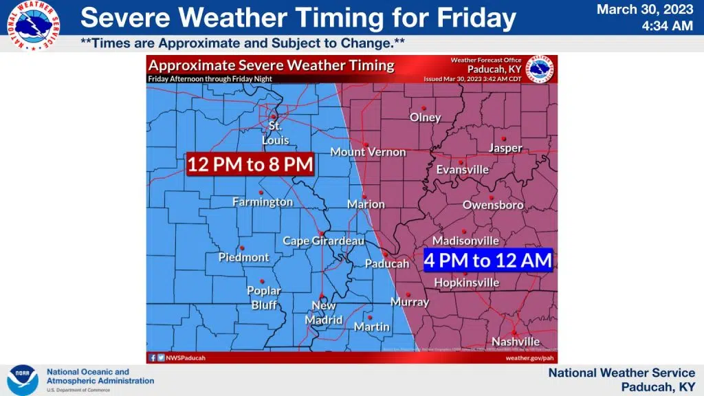
Gibbs says the timing for the event to move into western Kentucky will likely be about 3 p.m. to 4 p.m. through 10 p.m. to 11 p.m. Friday evening.
Storms that develop will be moving rapidly, so when a warning is issued, don’t wait to take shelter—take time to go over severe weather plans. Gibbs says the moderate could be expanded as more data comes in, but to not get too caught up in the colors on the map, as the entire area is under a risk for all forms of severe weather.
Stay tuned to the WHOP Family of Stations for any watches or warnings that could be issued for this developing storm system.