While it appears as though the worst of the flooding risk will remain to the north and west of the southern Pennyrile through Friday night, the chances of severe weather in our region are actually increasing.
There is now an enhanced risk for severe weather Friday afternoon and evening, with damaging winds, large hail and an isolated tornado the primary threats.
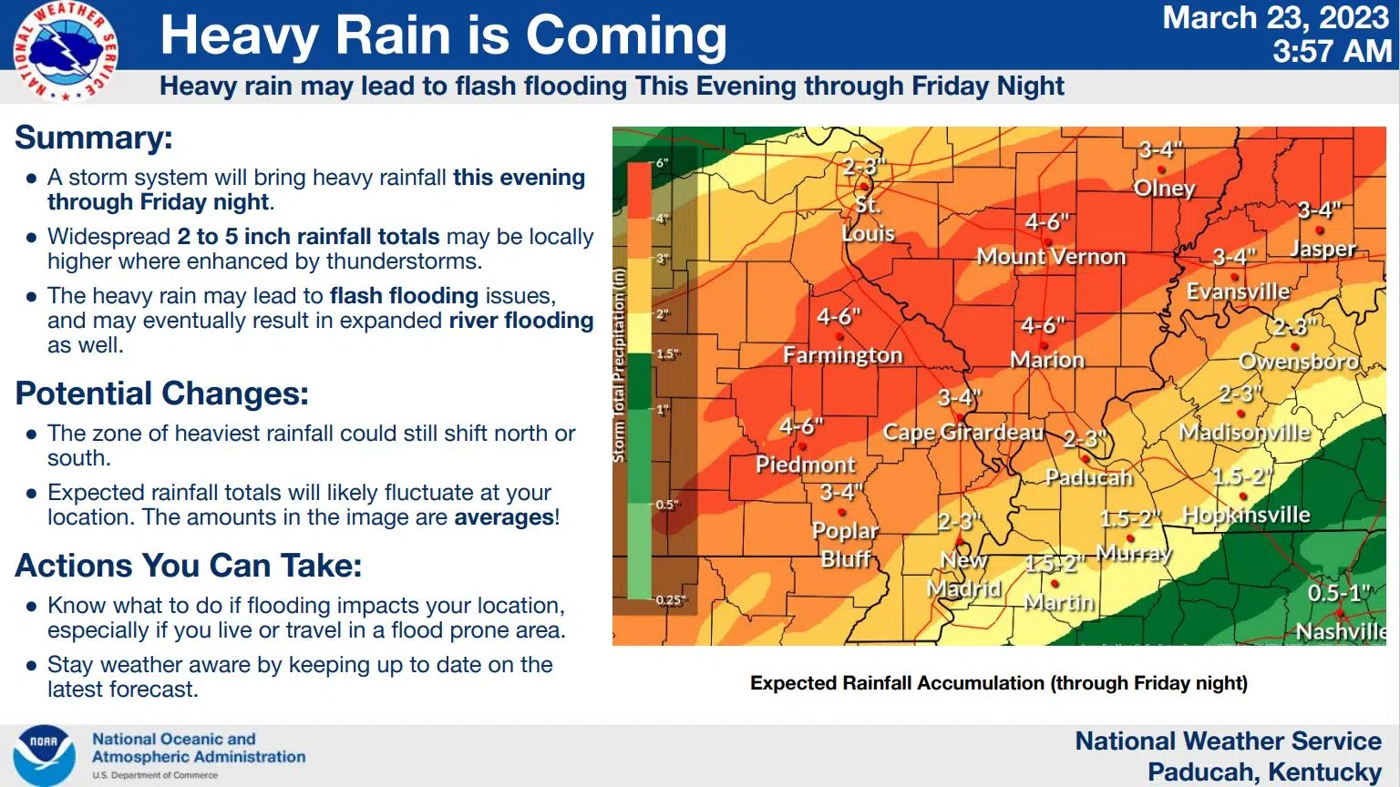
Meanwhile, the current forecast is calling for an inch and a half to two inches of rain across Christian, Todd and Trigg counties through Friday night and higher amounts to the north and west. A Flood Watch has been issued for counties near the Ohio River and flash flooding is still possible everywhere if a strong thunderstorm brings enhanced rainfall amounts over a short period of time.
Stay tuned to the WHOP Family of Stations and monitor our social media outlets for the latest on this storm system.