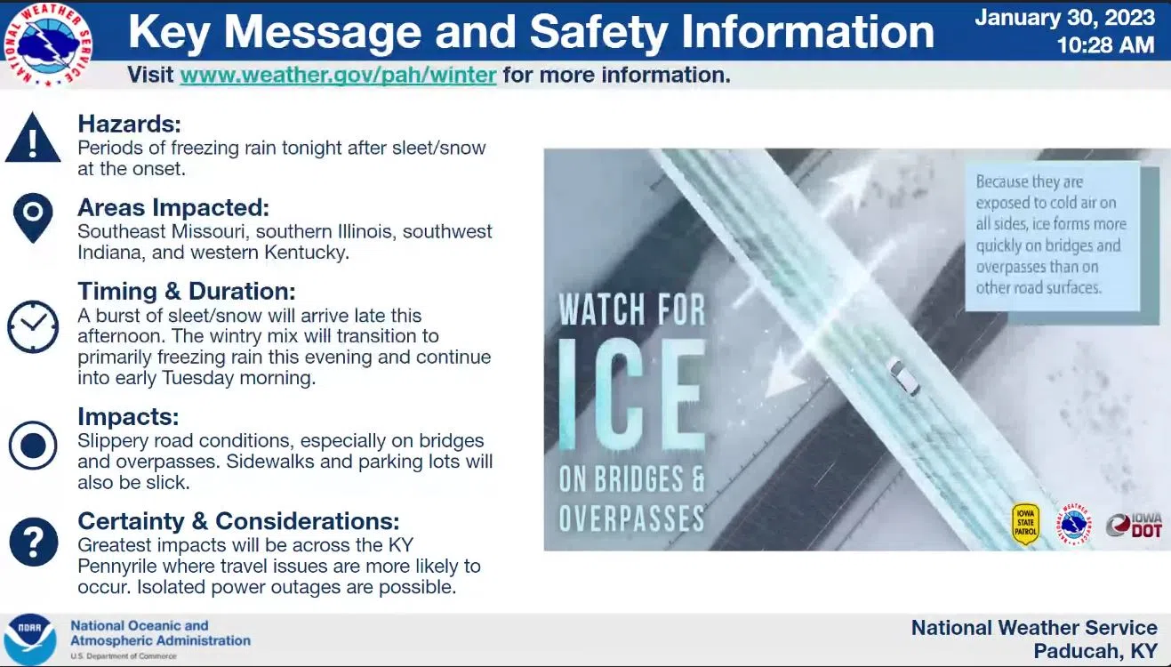
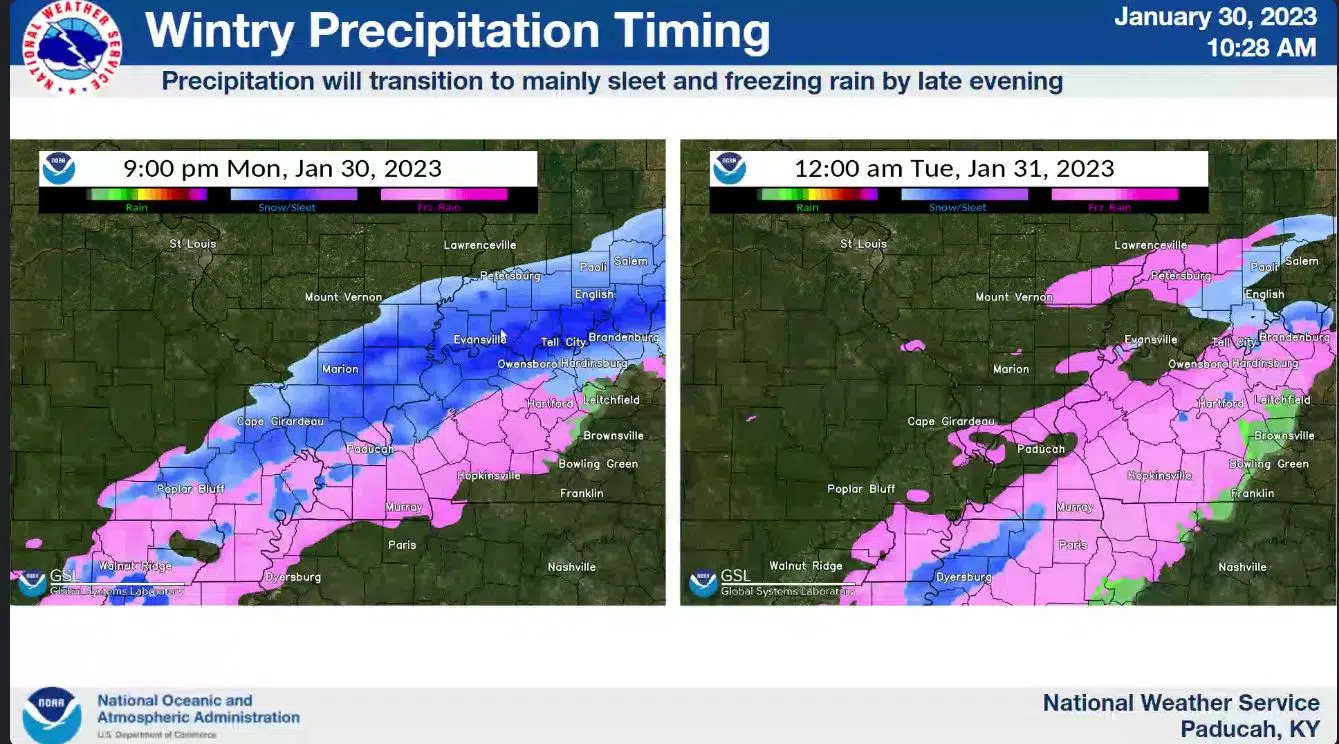
Traveling will likely be difficult Tuesday morning in Western Kentucky and Middle Tennessee, as freezing rain is expected to put ice on area roads.
A Winter Weather Advisory is in effect from 3 p.m. today until 9 a.m. Tuesday for the region, with up to two-tenths of an inch of ice accumulation expected on roads, trees and elevated surfaces.
Keith Cooley with the National Weather Service in Paducah said during a conference call Monday morning that while travel impacts will be the major concern, a few isolated power outages will be possible—especially with gusty winds.
He says the greatest impacts will be along the Kentucky-Tennessee border.
Freezing rain could begin as soon as 9 p.m. and it should be moved out of the area by 9 a.m.
Additional chances of wintry precipitation are in the forecast Tuesday evening and Wednesday night into Thursday morning, but confidence in those events coming to fruition is low and amounts are expected to be rather light.
Stay tuned to the WHOP Family of Stations and monitor our websites and social media outlets for the latest on these winter weather systems and for any potential closings and cancellations.