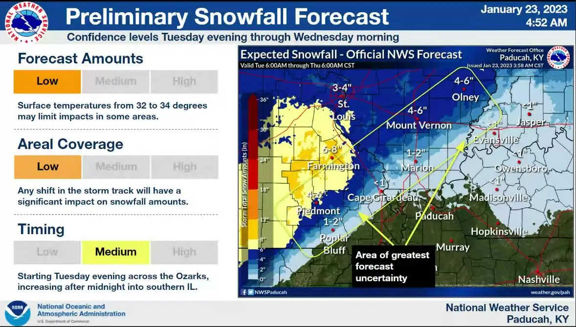
While portions of Missouri, Indiana and Illinois are bracing for a possible snowstorm Tuesday night and Wednesday morning, it’s appearing like it’ll be mostly cold rain in Western Kentucky.
National Weather Service in Paducah Meteorologist Sean Poulos says temperatures in Western Kentucky are expected to remain just above freezing.
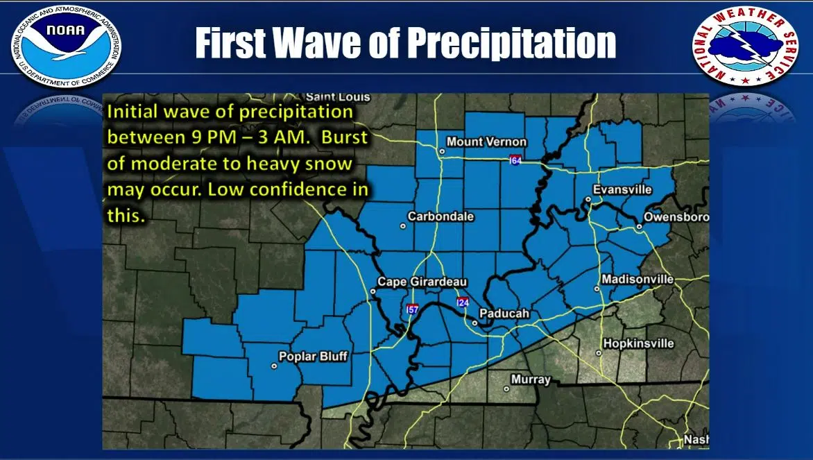
It’s possible areas north of Hopkinsville—especially closer to the Ohio River—could see a burst of heavy snow with the initial onset of the precipitation Tuesday night.
Major travel impacts are not expected at this time anywhere in Western Kentucky, but forecasters urge residents to keep an eye on the latest forecast just in case.
Meanwhile, the long-range outlook is showing about normal to slightly cooler than normal temperatures next week and above normal precipitation.
Flooding is not expected to be a concern with this week’s rain event, as about a half-inch to an inch of rain is expected to fall.