The National Weather Service in Paducah continues to monitor the likely chance for severe storms in western Kentucky Wednesday afternoon and evening.
The Storm Prediction Center has placed the majority of western Kentucky under a moderate risk for severe weather, including portions of Trigg County and northern Christian County, while the remainder of the region remains under an enhanced risk, with damaging winds, large hail, heavy rain and tornadoes all possible, according to Meteorologist Derrick Snyder with the National Weather Service in Paducah.
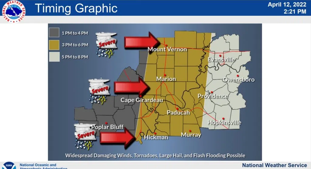
He says the timing of the storms in the region will be from afternoon into the evening, with the storms possibly moving into our area around 5 p.m.
Snyder says discreet supercells may form ahead of the main line and possibly generate longer lived tornadoes, but brief, spin up tornadoes will remain possible in the main line as well.
He says the region was upgraded to a moderate risk on the basis for the potential of widespread, severe wind gusts upwards of 70 miles per hour or higher possible. A flood watch has been issued for our entire listening area, in effect from Wednesday morning through Wednesday evening.
Snyder urged everyone to stay weather aware heading into Wednesday, have multiple ways to receive warnings and have a plan in place should a warning be issued for your location.
Stay tuned to the WHOP Family of Stations for any potential watches or warnings.