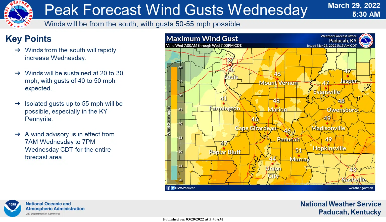
Severe weather continues to be a threat for Wednesday and Wednesday night in western Kentucky and middle Tennessee and strong winds will be a big story, even outside of any thunderstorms.
The Storm Prediction Center now has western Kentucky in an enhanced risk for Wednesday.
Christine Wielgos is the warning coordination meteorologist for the National Weather Service in Paducah and says a line of thunderstorms will develop with a cold front and move across the area sometime in the afternoon or evening.
Even if instability is lacking, Wielgos says there may still be enough ingredients in the atmosphere to produce severe weather, with damaging winds and a few tornadoes the primary threats.
It’ll be windy before the storms ever arrive, with Wielgos saying there will be sustained winds of 20 to 30 mph and gusts upwards of 50.
The National Weather Service in Nashville has already issued a Wind Advisory for all of middle Tennessee from 9 a.m. Wednesday until 1 a.m. Thursday.
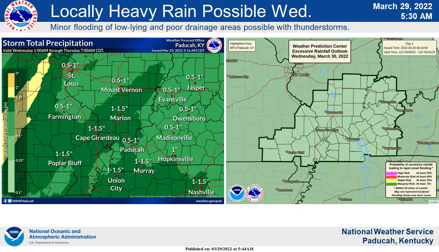
The region will likely get an inch to an inch and a half of rain with the cold front, but major flooding is not expected at this time.
Stay tuned to the WHOP Family of Stations for the latest on this developing storm system.