An Ice Storm Warning remains in effect until 6 a.m. Friday for all of western Kentucky and portions of Tennessee including Montgomery and Stewart counties, with significant impacts expected.
Temperatures are at or below freezing across all of western Kentucky after dropping throughout the night and precipitation will become more abundant through the morning and day.
Dispatchers in Christian, Todd and Trigg counties reported no weather-related issues as of about 5 a.m., but that’s likely to change as the storm ramps up.
Christian, Todd, Trigg, Hopkins and Muhlenberg County Schools are closed, in addition to UHA, Heritage Christian Academy, Sts. Peter and Paul Catholic School, Dawson Springs Independent Schools, Hopkinsville Community College and Madisonville Community College. Many of the local districts are utilizing NTI, with complete closures and cancellations on our website.
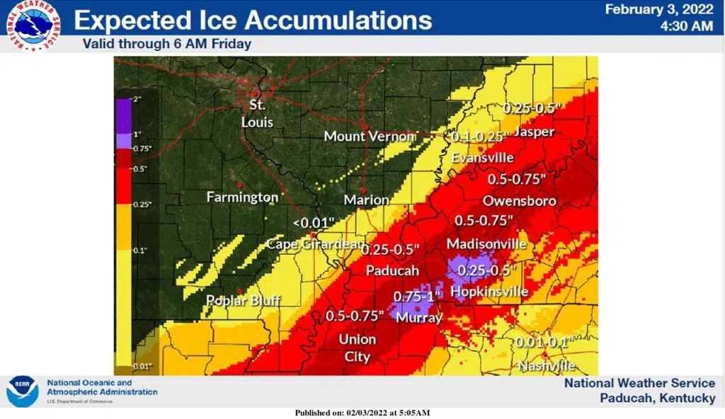
Three tenths to three-quarters of an inch of ice accumulation is expected in the southern Pennyrile, with a little more or less in some places, and National Weather Service in Paducah Warning Coordination Meteorologist Christine Wielgos says travel will become very difficult.
It’s hard to predict how widespread power outages will become, but outages will certainly be possible with the combination of ice and wind.
Wielgos says if you must travel Thursday, let someone know where you’re going and pack an emergency kit in your vehicle.
Stay tuned to the WHOP Family of Stations and monitor our websites and social media outlets for the latest on this winter weather system.