A significant outbreak of severe weather appears to becoming more likely for tonight and the storms could be made more dangerous by coming during the overnight hours.
Parts of Western Kentucky and Middle Tennessee remain under an enhanced risk for severe weather, while areas to the west, including a portion of Trigg County, have been upgraded to a moderate risk. Damaging winds and tornadoes are expected to be the primary threats. Forecasters say large hail and heavy rain will also be possible in some areas.
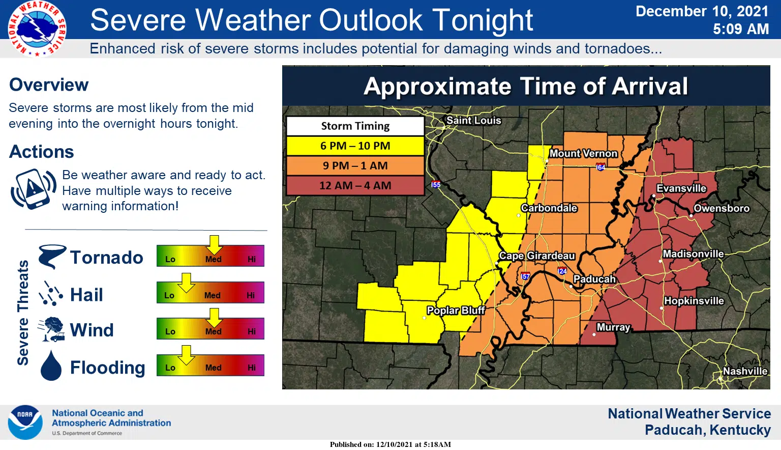
While it’s possible a few storms could develop ahead of an approaching cold front this evening, National Weather Service in Paducah Warning Coordination Meteorologist Christine Wilegos says the main event is expected overnight. That makes it especially important to have multiple ways to receive warnings after you’ve gone to bed and to have a plan of action in place for if a tornado warning is issued.
The current forecast has the main line of severe storms moving through Trigg, Christian and Todd counties between midnight and 4 a.m. The precise timing still remains uncertain.
Storms will be moving very quickly, so Wielgos says it’ll be important to get to a safe place fast if a warning is issued and to not wait around until you hear or see the storm arriving.
Stay tuned to the WHOP Family of Stations and monitor our social media outlets for any potential watches or warnings.