The most significant snowfall in several years is set to impact western Kentucky Sunday night and Monday and traveling will almost certainly become very difficult.
A Winter Storm Warning is now in effect for all of western Kentucky and middle Tennessee from 6 p.m. Sunday until 6 a.m. Tuesday. The current forecast is for five to nine inches of snow in western Kentucky, including in Christian, Todd and Trigg counties, where amounts are expected to be the highest
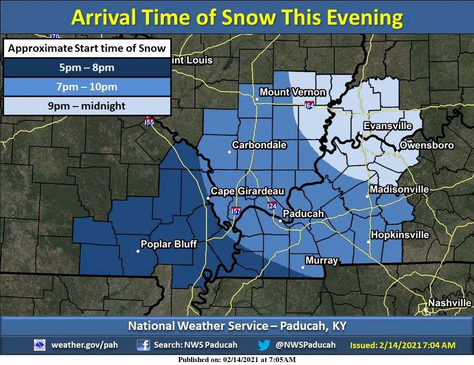
The National Weather Service in Paducah hosted a conference call with local emergency managers Saturday and Lead Forecaster Chris Noles says there will be two major rounds of snow in the region—the first Sunday afternoon and evening and the second Monday afternoon through the evening hours.
A mixture of snow with sleet or freezing rain could reduce snow accumulations in the southern Pennyrile, but Noles expects that to be more of a factor in our Tennessee counties.
Wind could cause some drifting of snow—especially Monday afternoon and evening.
Whatever falls will likely still be around when another possible winter storm is forecast to hit somewhere in the region sometime Wednesday night and Thursday. Details on that forecast are still being ironed out.