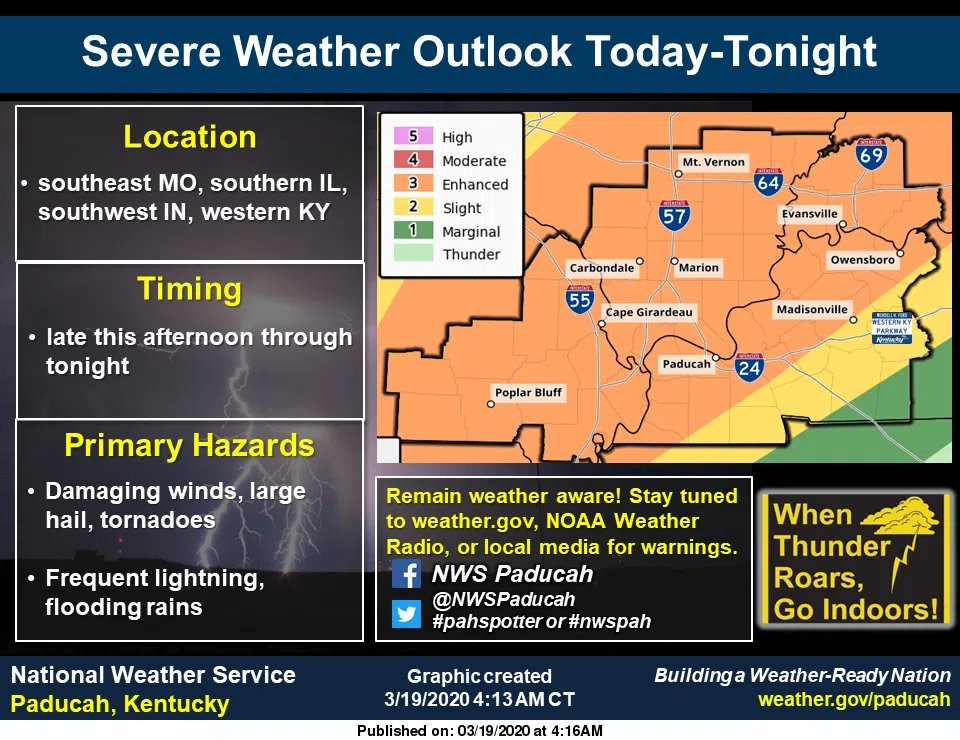
Most of the southern Pennyrile region remains under a slight risk for severe weather this evening and tonight and all of western Kentucky is under a flash flood watch through 7 a.m. Friday.
The risk for severe storms becomes greater toward the north and west, with the worst of weather expected in Christian, Todd and Trigg counties late tonight or early tomorrow morning. Damaging winds, large hail and an isolated tornado will be the primary risks.
Multiple rounds of heavy rainfall could cause flash flooding with the ground already saturated and creeks and streams already higher than normal. Low-lying and poor drainage areas will be most likely to issues.
Motorists who encounter standing water are reminded—turn around, don’t drown.
Stay tuned to the WHOP family of stations and monitor our websites and social media outlets for additional information.